
Sakshi Education
Survey of India released official map of newly formed state Telangana on state's first formation day. It described state's heritage and resources in the map as follows:
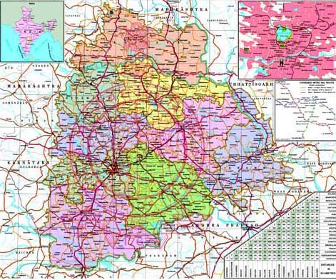
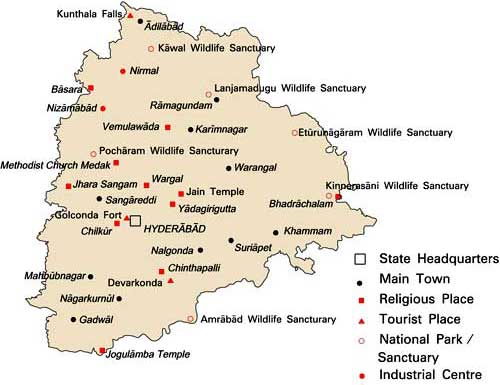
Important places in Telangana
- Telangana is the 12th largest state in India.
- Capital: Hyderabad
- Official language: Telugu, Urdu is the second most widely spoken language.
- Major rivers: Godavari on the north, Krishna on the south
- Small rivers: Bhima, Kinnerasani, Manjeera, Maner, Penganga, Pranahita, Dindi, Pedda vagu, Musi, Taliperu.
- Rice is the major food crop. Mango, tobacco, sugarcane, cotton are the other crops.
- Telangana culture is a mixture of Telugu and Persian traditions.
- Kuchipudi is the important classical dance form.
- Folk arts like Burra katha, Shadow puppet show are unique arts and crafts.
- Hindu, Islam are major religions and Bonalu, Bathukamma are major regional festivals.
- Saraswati temple in Basara, Jogulamba Temple at Alampur, Chilkur, Yadagiri gutta, Bhadrachalam and Nagarjuna Sagar are the important places to visit.
Important places in Telangana
- Maharashtra (North, North-West)
- Chattisgarh (North-East)
- Odisha (East)
- Andhra Pradesh (South)
- Karnataka (West)
Published date : 08 Jun 2015 02:01PM