Sakshi Education
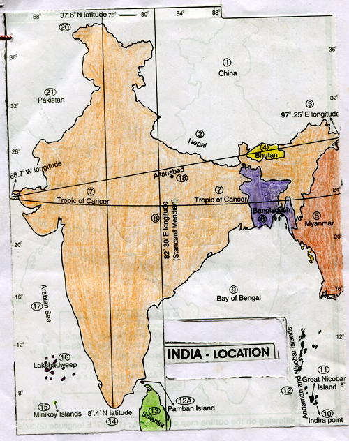
Observe the map and answer the following questions
- Name the islands that belong to Indian union.
A. Andaman, Nicobar islands, Lakshadweep, Minicoy islands
- Where is Indira point?
A. Indira point is in Greater Nicobar Island. It is named after the former and first women Prime Minister of India.
- What is the northern most latitude of India?
A. 37061 is the northern most latitude of India.
- What is the southernmost latitude of India (in degrees)?
A. 8041 N is the southernmost latitude of India.
- Name the easternmost and westernmost longitudes of India?
A. 970251 E is the easternmost and 68071E is the westernmost longitudes of India.
- What is the north-south distance of India?
A. 3214km.
- What is the east-west distance of India?
A. 2933km.
- Where is Pamban island?
A. Pamban island is between India and Srilanka.
- In between which latitudes and longitudes is India located?
A. India is between
(a) 68071E and between
(b) 8041 and 37061 North latitudes.
Published date : 30 Jan 2015 03:44PM